

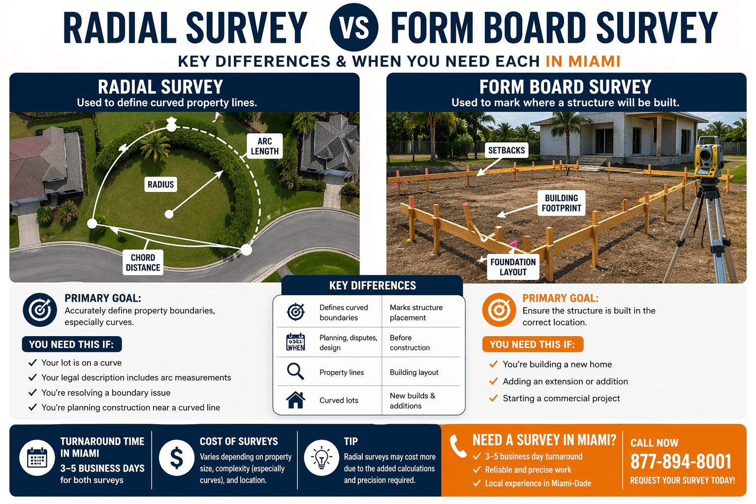
Radial Survey vs. Form Board Survey in Miami: What’s the Difference?
Not sure whether you need a radial survey or a form board survey in Miami? A radial survey defines curved property lines, while a form board survey ensures your structure is built in the correct location before construction begins. Learn the key differences, when each is required, and why many properties in South Florida need both—typically with a 3–5 business day turnaround.

Do You Need a Survey for a Permit in Miami-Dade County?
If you're applying for a permit in Miami-Dade County, you may need a land survey. Learn when surveys are required, what type you need, and how fast you can get one completed.
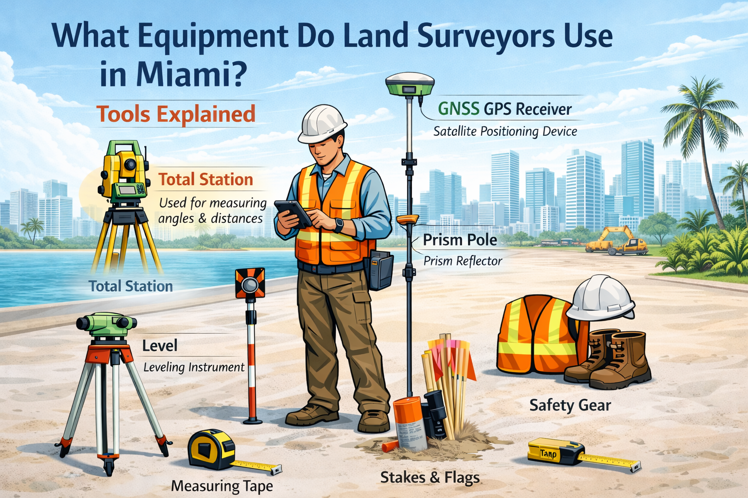
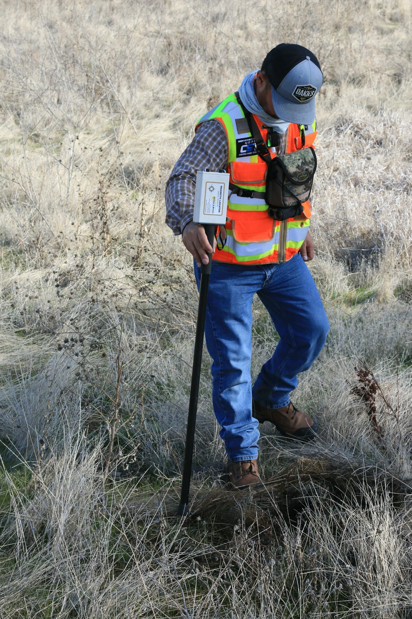
What Does a Surveyor’s Equipment Look Like – And Why It Matters for Your Miami Property
Ever wondered what tools land surveyors use on job sites around Miami? From high-precision total stations to GPS receivers and prism poles, modern surveying equipment allows professionals to measure land accurately, establish property boundaries, and support construction projects throughout Miami. Understanding these tools helps explain why professional surveys are essential for property owners, builders, and developers.
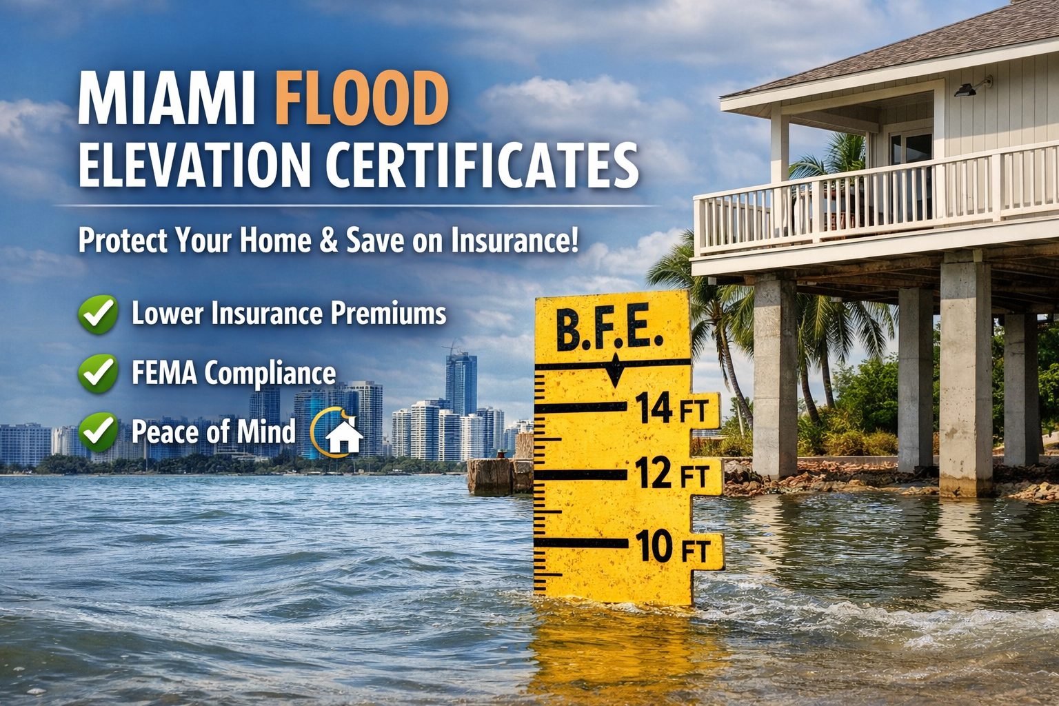
Miami Flood Elevation Certificates: How They Protect Your Home and Insurance Rates
Protect your Miami home and save on flood insurance with a professional Flood Elevation Certificate. Learn how accurate elevation data can lower premiums, ensure FEMA compliance, and give you peace of mind.
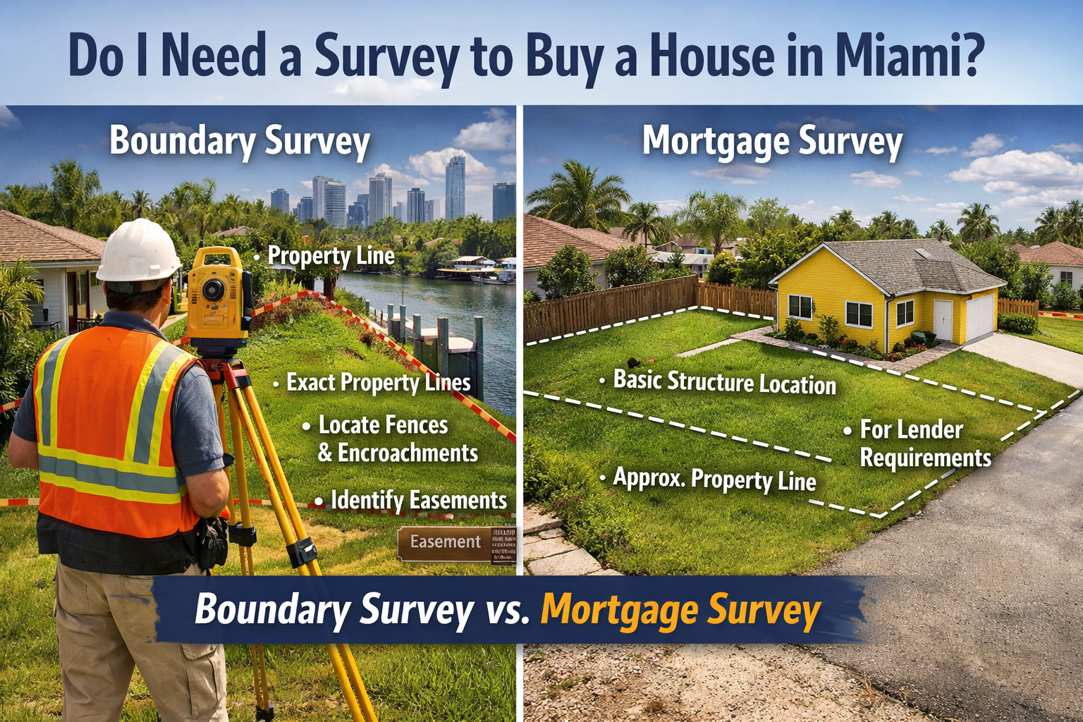
Do I Need a Survey to Buy a House in Miami?
Wondering if you need a survey to buy a house in Miami? Discover the differences between boundary and mortgage surveys, why lenders and title companies require them, and the risks of skipping a survey in South Florida.
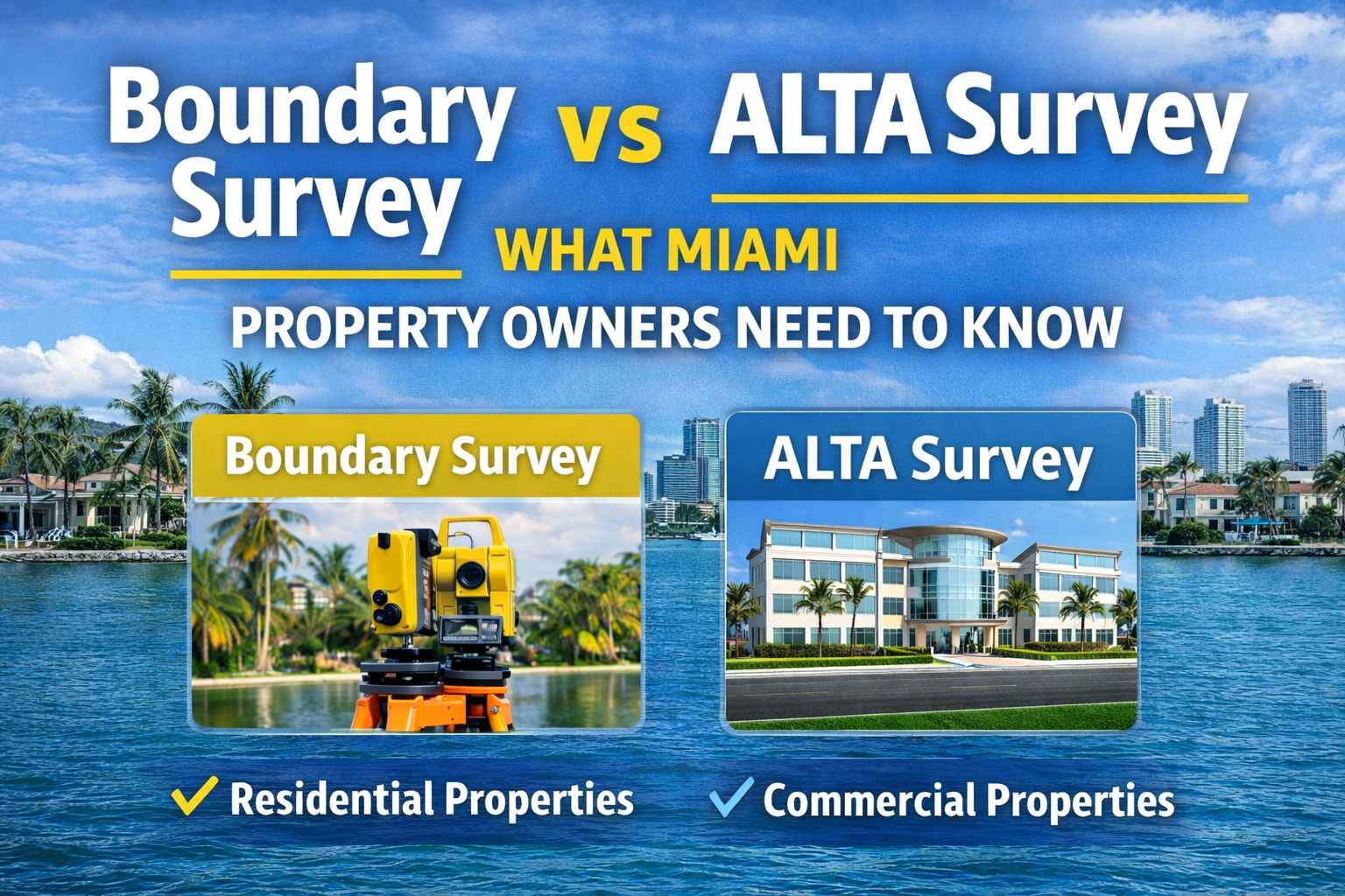
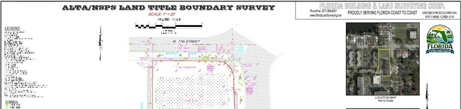
Boundary Survey vs ALTA Survey in Miami: Which One Do You Need?
If you’re buying, selling, or developing property in Miami, understanding the difference between a Boundary Survey and an ALTA/NSPS Land Title Survey is essential. Each survey serves a unique purpose, from marking property lines to protecting lenders and title companies.
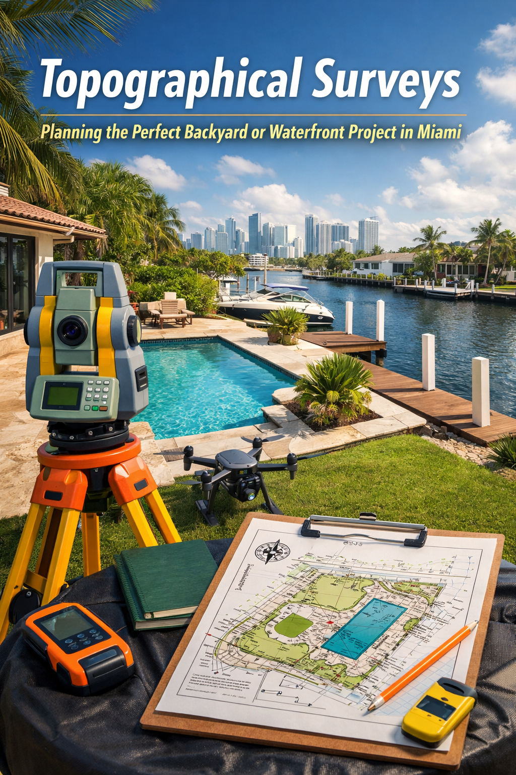
Topographical Surveys: Planning the Perfect Backyard or Waterfront Project in Miami
Planning a backyard pool, waterfront dock, or tropical landscaping in Miami? A topographical survey provides precise elevation and boundary data, helping you avoid flooding issues, comply with local regulations, and design the perfect outdoor space tailored to your property.
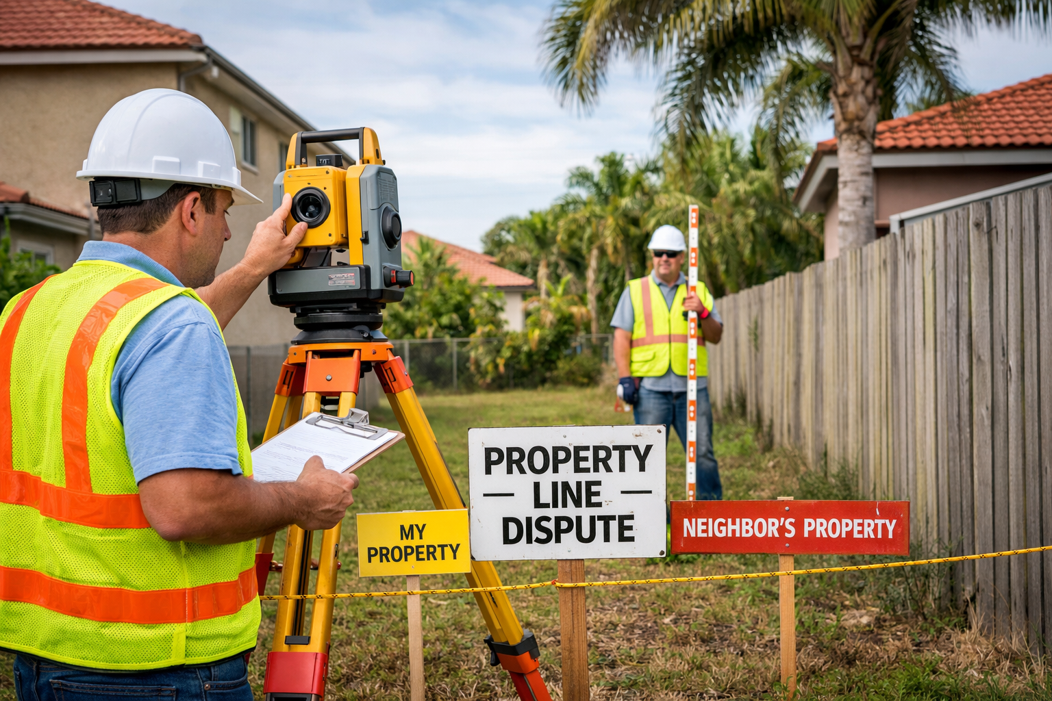
Common Property Line Disputes in South Florida (And How Surveys Solve Them)
Learn the most common property line disputes in South Florida, including fence encroachments, easements, and waterfront boundaries, and how professional land surveys resolve them.
An In-Depth Look at Boundary, ALTA, and Flood Elevation Surveys
Need a licensed land surveyor in Miami, FL? We provide ALTA surveys, boundary surveys, topographical surveys, and elevation certificates for residential and commercial properties throughout Miami-Dade County. Get your quote today!

Why Miami-Dade County Needs Flood Elevation Certificates?
Miami-Dade County is one of the most flood-vulnerable areas in the United States. With its low elevation, coastal location, heavy rainfall, hurricanes, and high groundwater levels, flooding is a constant concern for homeowners, buyers, and builders across the county.
Because of this risk, Flood Elevation Certificates play a critical role in flood insurance, permitting, and property compliance throughout Miami-Dade County.
Understanding the New 2026 ALTA Survey Standards
If you’re buying, selling, refinancing, or developing property, chances are you’ve heard the term ALTA survey thrown around by lenders, title companies, or attorneys. For most people, it sounds technical—and frankly, a little intimidating. With the new 2026 ALTA/NSPS Land Title Survey Standards officially taking effect on February 23, 2026, there are some important updates that property owners should understand, without needing an engineering degree to do so.
Let’s break it down in plain English.

Surveying Amidst Art
On September 24th, Florida Building & Land Surveying Corp. conducted a boundary and construction survey at Miami’s iconic Wynwood Walls in Midtown.
Seawall Restoration Survey
Florida Building & Land Surveying completed a construction survey in North Miami Beach to support the restoration of a seawall. Using advanced GPS and robotic total station technology, our team provided precise data essential for planning and executing resilient waterfront projects.